
| [Home] | [Locations] | [Links] | [About] | [Extras] | [Contact] | [Donate] |

Posted: Monday April 1, 2013

Walking along train tracks is an entertaining way to kill boredom and potentially even yourself, as some may view the potential danger of a barreling train out to be. As a kid, adults would tell me to stay off the tracks, so I didn't. Instead I walked the tracks, I discovered some awesome industrial ruins, I developed a fascination for trains and railroad infrastructure, I saw lots of interesting and crude graffiti, and I stayed alive. I then forgot about trains for a number of years as I stopped walking the tracks, instead I got caught entirely way too much up with only abandoned buildings. It wasn't until discovering some abandoned Amtrak cars a couple of years past that my railroad fascination was re-kindled. So I started poking around rail lines again and watching trains as they'd pass by, it reminds me of being a kid again.
The rugged, hilly topography significant of Northern New Jersey must have been an engineering nightmare during the early days of laying the railroad beds. To combat the terrain, rail lines twist and turn up steep slopes and numerous trestles cross over valleys, highways, rivers, and gorges. The trestles in particular I find to be quite interesting, for they are generally all very similar in design, but never quite identical. Some are long, some are tall, wide, skinny, but all interesting to walk over and under.
Scouring over Google Maps as I tend to waste many hours doing, I discovered a particular trestle that I never knew about before. It lay along an active rail line within a section of forest along the outskirts of a steep hill. The trestle was built to cross over a section of the Pequannock River and looked to be fairly long considering the river isn't very wide. I took advantage of a cold and snowy day as an opportunity to check out the trestle for myself. And so I walked along the tracks, trudging through a crunchy layer of old snow for about half a mile, until I reached the trestle. An imposing sight it was, certainly much more grande in person than any satellite aerial could portray. It also incorporated a interesting open design, as the trestle almost looked like it was built upside down because the steel support frame and girders ran entirely underneath the trestle as opposed to along the tracks forming a wall, which is most common to see. I climbed down the snowy embankment to grab some shots of the trestle underside, where I discovered a curious and massive cement pipe which I believe was (or potentially is) used to direct water to a near by filtration plant where the water is then sent out to the city of Newark, NJ.
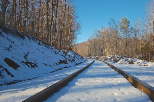 |
A low track perspective, featuring the Ramapo Mountain Fault Line which can be seen between the trees in the distance as a rising hill.
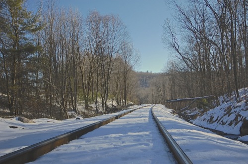 |
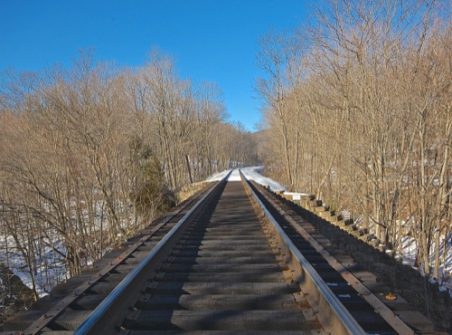
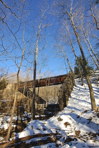
Looking south towards the train trestle which exists about one hundred feet or so in the distance.
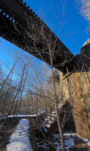 |
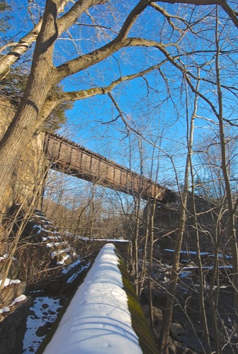
Standing beneath the trestle on the large cement pipe line which runs under. I'm not sure the purpose of the cement stair-like feature jetting into the side of the trestle support wall. Perhaps it adds additional strength?
 |
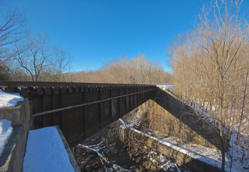
The bare trees made it easy to photograph the full scale of the trestle in a single frame.
 |
A closer look at the pipeline. It appeared to be intact as far as I could tell, however I wasn't able to hear any water running though.
 |
 |
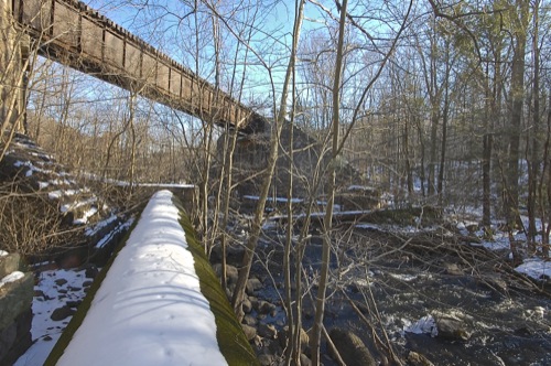
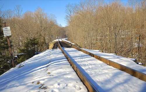
Standing alongside the edge of the rail ties. Again the pipe line can be seen running below for a few hundred feet before it disappears into the Earth. Just past the tree line is a water filtration plant, where I would assume the pipe emerges again.
 |
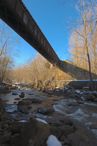
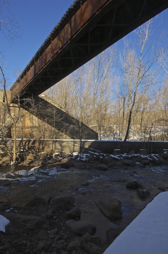
The cement and stone foundation supporting the bridge was built into the embankment of a steep hill and the sides gradually taper down to the river below. Interestingly, the edges of the foundation were built very much likes large steps making for an easy descent to down and under the trestle.
 |
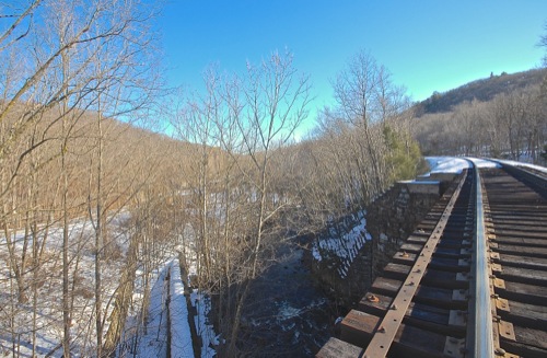
Standing up top the trestle. No trains in sight yet!
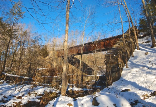 |
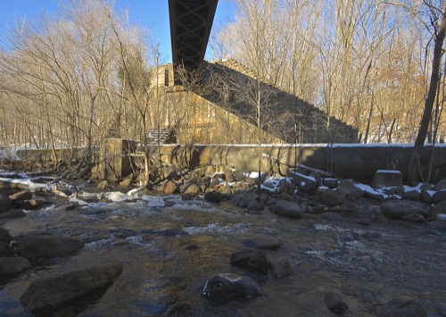
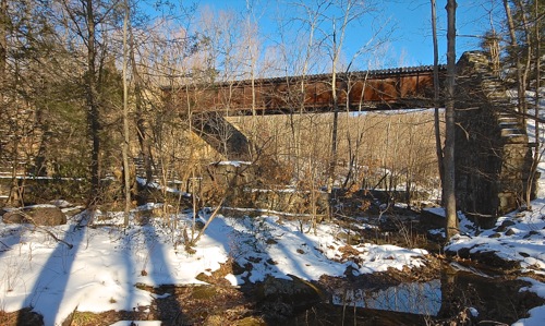
Gazing at the rusty trestle from across the river. The stair-like stone support foundation can bee seen towards the right side of the picture.
 |
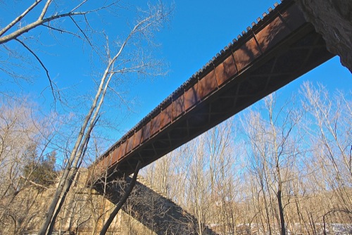 |
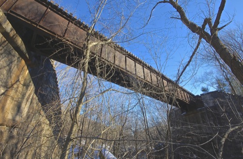
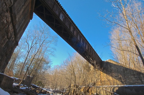
From this vantage the criss-crossing steel truss support beams of the trestle underbelly can be seen.
 |
Any icy and fridgid Pequannock River, certainly not an ideal day to fall in!
 |
Standing beneath the trestle again on some river rocks.
 |
It appeared possible to squeeze into the interior underbelly of the trestle's iron infrastructure, however the cement foundation leading to a possible entrance was covered in ice and snow; I decided not to press my luck.
 |
Railroad ties protrude slightly over the edge. I was hoping a train would pass over as I was underneath, but no such luck this time around.
 |
I wasn't able to find any official information or statistics detailing this specific trestle. However using my better judgement I'd say the bridge spans a solid 150 feet, standing at perhaps 50 feet tall.
 |
