
| [Home] | [Locations] | [Links] | [About] | [Extras] | [Contact] | [Donate] |

Posted: Friday September 21, 2012

Preface:
I had read an article posted in the local newspaper hinting at the possibility of a pair of abandoned pedestrian tunnels existing within a tract of woods local to the town of Butler, New Jersey. According to the write-up, the tunnels were constructed sometime during the early 1930's as a means of connecting a plot of land that had been severed during the construction of state highway, Route 23. The significance of the tunnels are that they were supposedly ordered to be built by Benedict Lust, key founder and father of naturopathic medicine in the United States. Today naturopathic medicine is largely regarded as a pseudoscience medical practice as it is based on the belief of vitalism. However during the early 1900's before modern medical advances, such medicine ideals and values were quite commonly practiced. The naturopathy viewpoint assumes a belief in natural nature cures as well as in a unique human energy called vital energy, which if harnessed, has the power to guide and heal certain bodily processes, such as reproduction, growth, and metabolism.
Benedict Lust was best known for establishing and running various naturopathic based health resorts around the country. One of his resorts, the Yungborn Health Resort (also referred to as Yungborn Sanatorium), opened on September 15th, 1896 and was located in Butler, New Jersey. The resort thrived and catered to over 100 guests up and through the early 1900's. However during the 1930's plans were finalized to construct a highway, which would ultimately cut through and divide the Yungborn Health Resort property in two. Lust, not wanting the loud noises and other negative aspects associated with highway travel to disturb the ethos of naturopathic practices, proposed the idea of building a pedestrian tunnel. In 1934 such a tunnel was constructed, allowing the resort guests to roam from one half of the property to the other, without having to cross or even see the highway. As years past and groundbreaking advances in medicine were discovered, ideas associated with naturopathy fell largely out of fashion due to scientific disproval, and the final fate of the Yungborn Health Resort ultimately fell to the wrecking ball. Much of the current parcel of land has been paved over into a car dealership mega-lot, however a small patch remains left to nature; a small overgrown stretch of forest better known to locals as Stony Brook.
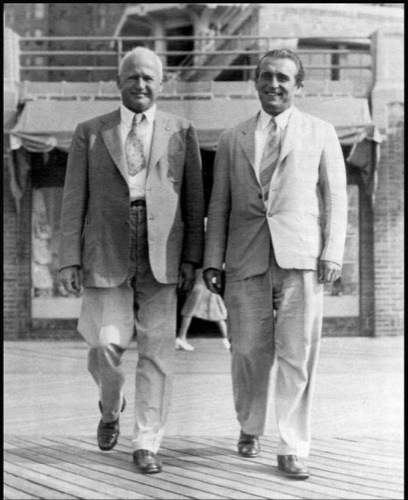
Image courtesy of LA84 Foundation. |
Pictured left is Benedict Lust accompanied on the right by Dr. Jesse Mercer Gehman, author of Smoke Over America, a book detailing the hazards associated with cigarette smoke. Photograph circa 1935.
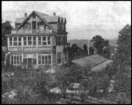
Image courtesy of LA84 Foundation. |
The main recreation building at the Yungborn Health Resort in Butler New Jersey. Photograph circa 1911.
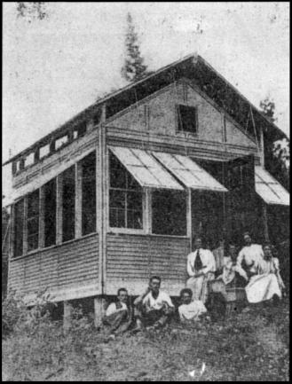
Image courtesy of LA84 Foundation. |
An "air cabin" at the Yungborn Health Resort. These cabins where built with ventilation in mind as it was believed that exposure to fresh mountain air was therapeutic and could heal such diseases as tuberculosis.
Postcard courtesy of ND Health Facts. |
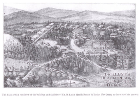
A postcard detailing an artist's rendition of Dr. B Lust's Health Resort "Yungborn" in Butler New Jersey during the turn of the century.
Postcard courtesy of Google Images |
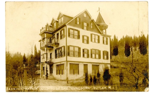
The main administration building at the Yungborn.
Postcard courtesy of Preziosi Postcards. |
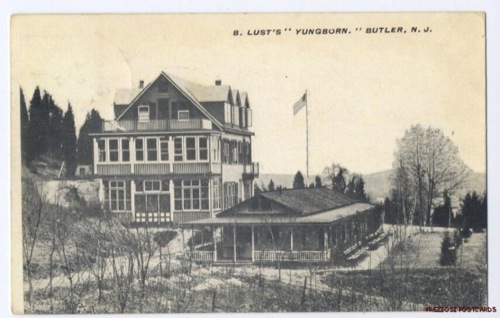
An alternate view of the Yungborn Resort with an air cabin pictured near the foreground.
An Adventure:
Near nothing remains to indicate the former existence of the once famed Yungborn Resort. However I knew there was a good chance that the walking tunnels hinted about in the newspaper article might still exist somewhere within the wooded section of what once was resort property. Wanting to prove my suspicion of possible tunnel existence, I chose a particularly miserable, muggy, humid, and hot summer afternoon, and set out with plans to walk the forest; for exploring drenched in sweat makes any adventure all the more thrilling. With the plot of land I needed to cover being fairly small, I knew I would be able to sweep the entire woods, all the while looking for the tunnels; if they did in fact, still exist.
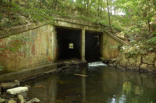
A failed start led me to follow a dehydrated creek leading to a drainage pipe which indeed cut underneath the highway, however the circumference of the opening was far too small to have ever been used for human travel. Fortunately I knew of a larger stream which also cut through the same wooded property. A short skip across the forrest dumped me out along the bigger stream's rocky bank which was littered with smashed beer bottle glass, various plastic debris, crushed aluminum cans, and cigarette butts. The garbage signaled I was on to a good lead, for party and drug paraphernalia generally points to a cool party spot, and where else would a bunch of rebellious teens rather pound a few cold ones, then inside an abandoned tunnel?
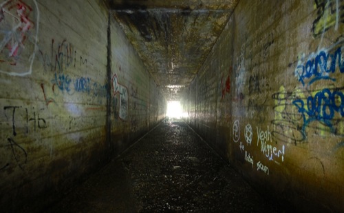
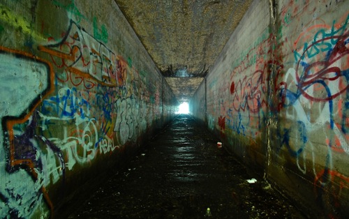
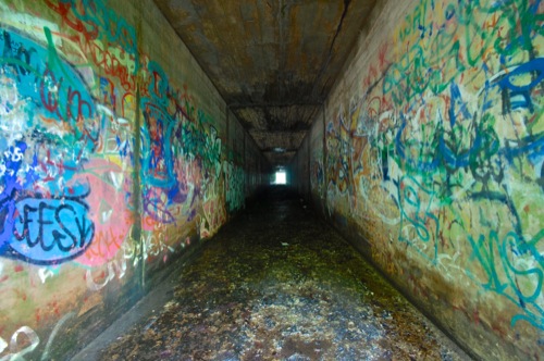
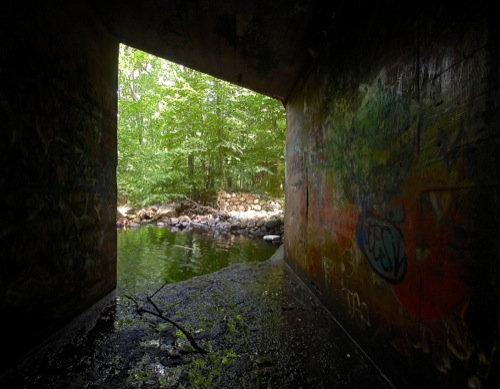
Following the trash trailed proved worthwhile, for soon enough a cavernous concrete structure appeared through the lush green foliage. Walking up closer I knew I discovered what I was searching for, as the height was perfect for a walking sized passage. A date of 1934 stamped into the concrete remained clearly visible, a number which coincides with the timeframe of the Route 23 installation. The tunnel bore was sanctioned into two parts by a cement wall, with one side used to direct a natural brook, however it was the adjacent side which was most likely used by guests cutting across the property. The reinforced cement walls stained with layers of graffiti sprayed by decades worth of curious and bored kids, made the tunnel slightly more interesting and colorful to photograph. Walking through to the opposite end I confirmed that the tunnel did indeed pass underneath the highway, as it let out right to where the auto lot sits. While the graffiti was telling that I certainly hadn't been the first person to rediscover the tunnels, I just might have been the first to traverse them knowing well the lesser known story behind their placement.
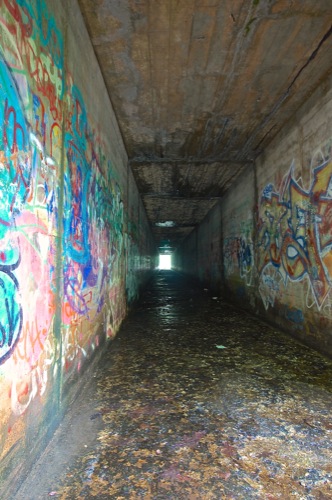 |
Layers of graffiti now cover the cement walls.
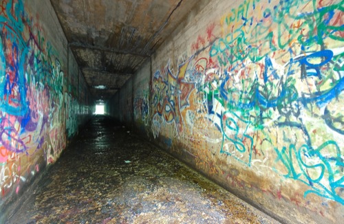 |
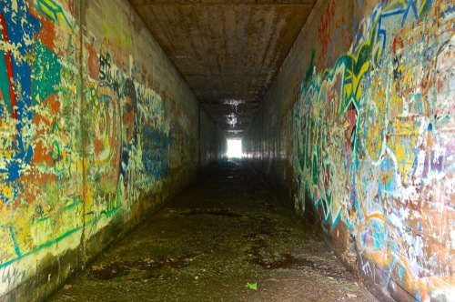
The tunnel is only about 150 feet in length and cuts about 20 feet below the pavement of route 23.
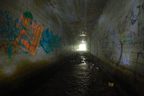 |
The center of the tunnel was just dark enough to where I needed a flashlight to illuminate the surroundings. The white streaks along the walls are not graffiti but rather light beams from my flashlight caught within a long exposure photo.
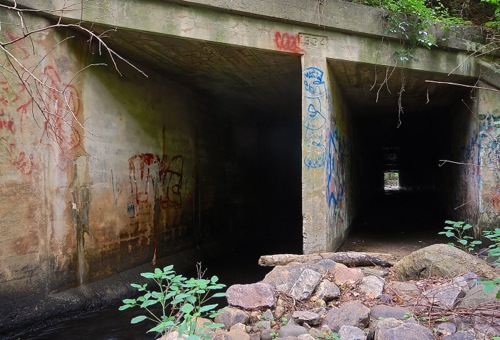 |
Pictured is the inlet entrance closest to the car dealership lot. A date of 1934 is clearly stamped into the cement just above the dividing median. On the left side of the cement divider a small creek flows through. The base of the tunnel on this side was significantly lower and pitched as compared to the level right side.
 |
I was thrilled not to find a single cave cricket living inside the tunnel; a very surprising discovery considering the cool damp conditions within were prime for masses of the disgusting insects to thrive.
|
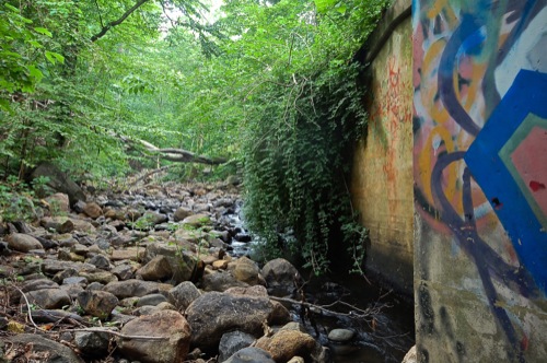
The rocky riverbed behind the tunnel.
 |
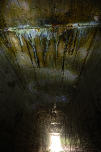 |
Water slowly seeps in from between the gaps in the cement, forming gnarly looking stains.
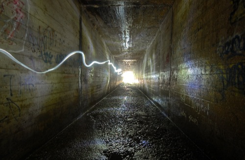 |
Ghost of my flashlight.
 |
 |
 |
 |
The water was quite deep this side of the tunnel. A web of near impermeable trash and natural debris caught between the rocks in the riverbed created a dam, causing the water to pond up and form a stagnant puddle, a good four feet deep.
